Zoning for TOD
Zoning regulations dictate what is allowed to be built and where, ultimately allowing municipalities to shape the look and feel of their neighborhoods. Zoning can regulate key aspects of transit-oriented development such as the building’s height, proximity to the street, coverage of the lot, allowable uses, first floor design, and parking.
Cuyahoga Context
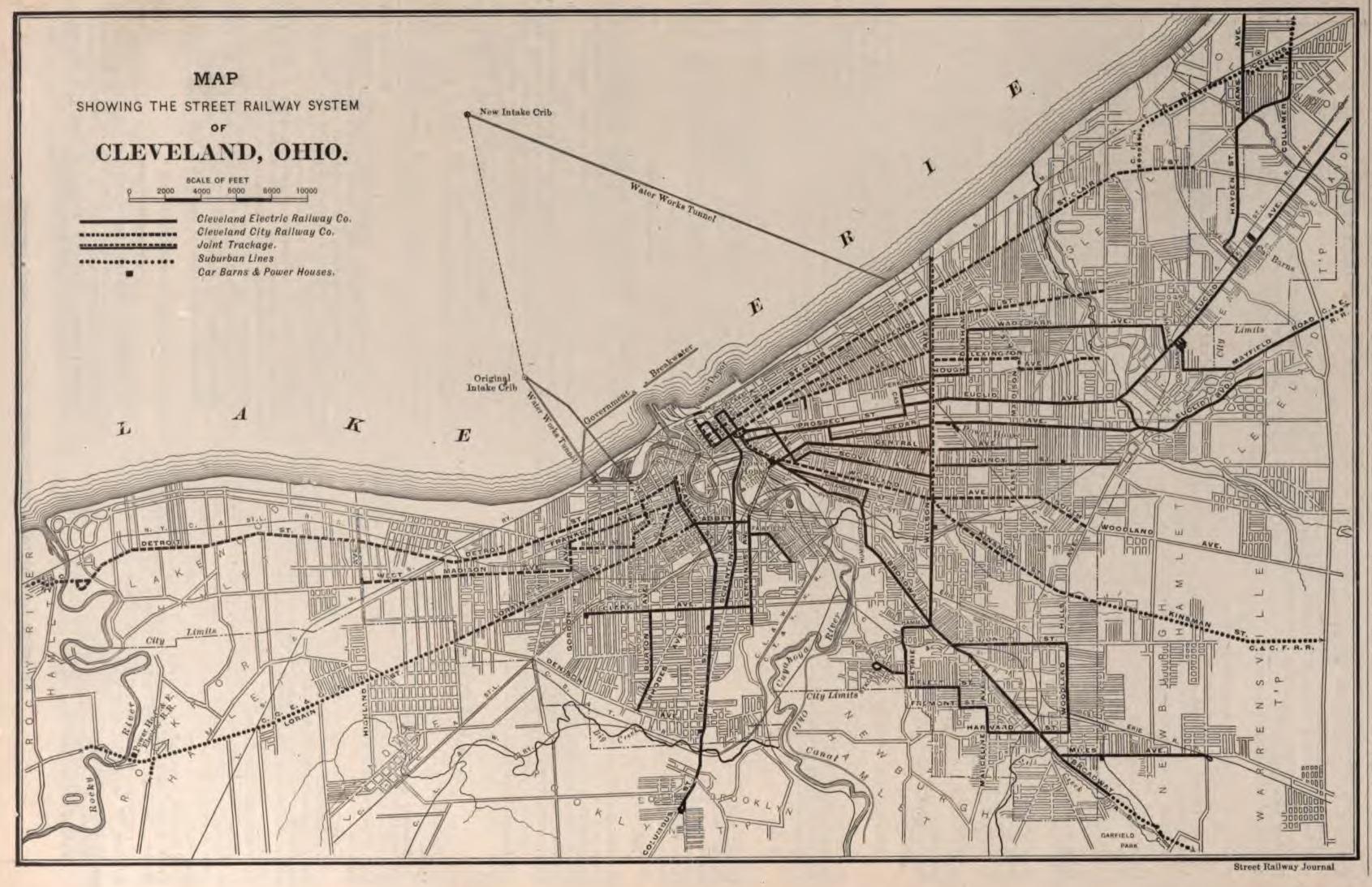
Historically, the City of Cleveland and Cuyahoga County’s inner-ring suburbs had dense, mixed-use commercial districts along streetcar lines that were characteristically TOD, therefore creating vibrant, connected communities. However, many communities adopted zoning codes in the mid-twentieth century that laid out regulations prioritizing the personal vehicle and disallowing this historic TOD typology.
These zoning codes separated uses, minimized heights and lot coverages, and required an abundance of parking with the building set back far from the street. Such regulations led to sprawling, disconnected developments that catered to vehicle access.
Local TOD Zoning Updates
In 2023, the TOD Zoning Analysis found that only 5.5% of land adjacent to TOD corridors had zoning classified as “Most Supportive” of TOD, indicating significant regulatory barriers to developing TOD.
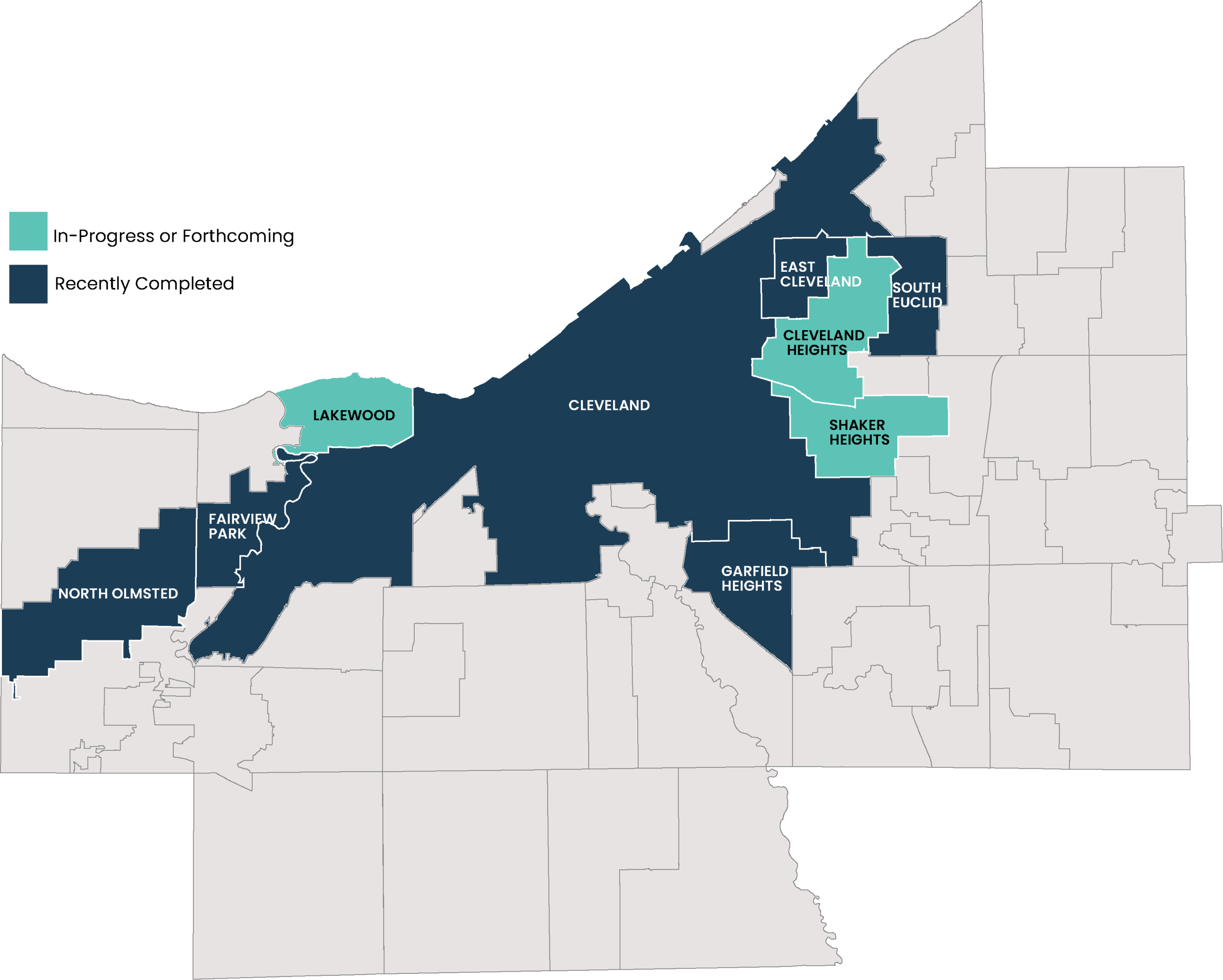
Since that time, multiple communities have undertaken zoning reforms. Featured here are TOD Communities that have recent or upcoming zoning changes to better enable TOD. Three examples below demonstrate the range and impact of these efforts.
Visit the TOD Navigator for the latest updates on zoning initiatives.
Last updated: September 2026
Cleveland Neighborhood Formed-Based Code
Adopted by Cleveland: March 2024, expanded in June 2026
First applied to three pilot neighborhoods, and later expanded to two more neighborhoods in 2026, the formed-based code was passed to support the City’s 15-minute City initiative.
South Euclid MU-TOD Zoning District
Adopted by South Euclid: May 2025
Working with County Planning, South Euclid adopted a Mixed-Use Transit-Oriented Development (MU-TOD) Zoning District which provides regulations for higher-density, mixed-use, and pedestrian-friendly development.
North Olmsted Mall Area Mixed-Use Overlay District
Adopted by North Olmsted: June 2025
Working with County Planning, North Olmsted adopted a Mall Area Mixed Use Overlay District to promote the redevelopment of the Great Northern Mall area into a compact, mixed-use, walkable and vibrant neighborhood.
Zoning Resources
Through collaboration with partners, peer communities, and local municipalities, County Planning developed the following resources to help guide municipalities as they evaluate and revise their zoning codes.
Best Practices for TOD Zoning
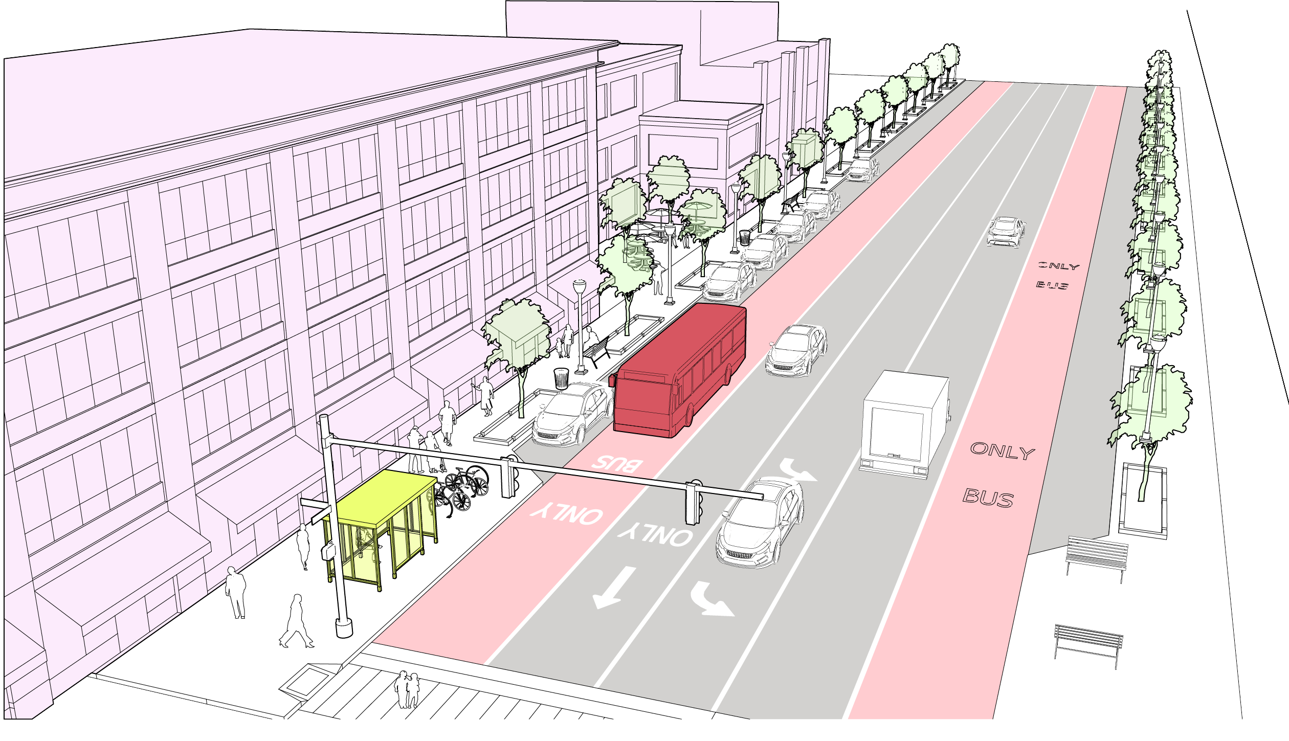
The Best Practices for TOD Zoning guide includes seven overarching principles for reforming zoning and development policies with detailed considerations, graphics, and local examples.
The seven best practices for updating policies and zoning to support TOD include:
- Allow for increased density
- Mix uses appropriately
- Get parking right
- Design buildings for walkability
- Foster vibrant public spaces
- Provide safe connections
- Prioritize affordable housing
Model TOD Overlay District + Annotated Guide
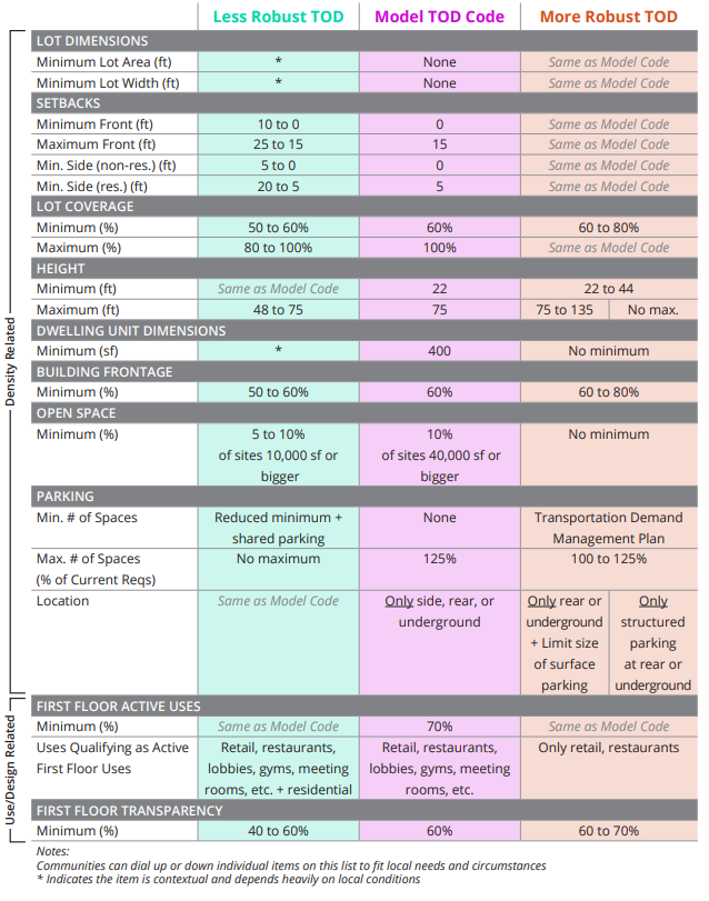
The Model TOD Overlay District and Annotated Guide provide example language for TOD zoning with considerations for how to tailor the model code to accommodate different levels of desired TOD.
Key aspects communities should consider when determining the level of TOD that is appropriate for them:
- The community's current circumstances and desired future result
- The existing transit availability and demand
- The level of existing and desired density
- The presence and scale of existing commercial or retail in the area
- The presence of regional destinations
The Model TOD Overlay details one path toward supporting denser, mixed-use development that contributes to a pedestrian-friendly environment around transit lines. The provided table outlines where the Model Code is most appropriate and how it can be calibrated for less or more robust TOD.
PARTNERSHIP
Cuyahoga TOD is a partnership between the Cuyahoga County Planning Commission, Greater Cleveland Regional Transit Authority, Port of Cleveland, City of Cleveland, and Cuyahoga County.