TOD Navigator
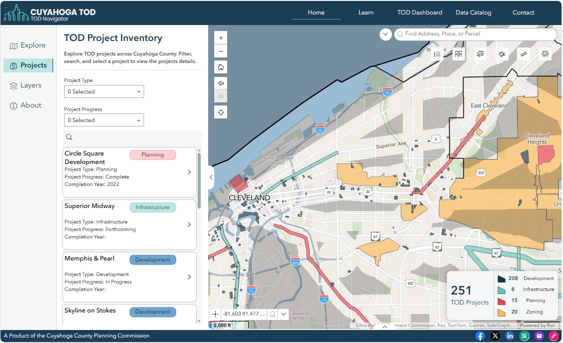
The TOD Navigator is an online mapping tool that features approved, in-progress, and completed TOD projects. Project data includes location, progress, and details such as retail square footage, gross square footage, number of units, and number of parking spaces.
The TOD Navigator includes information on developments, infrastructure improvements, planning projects, and zoning changes. Data is based on local input, review of Fiscal Office Delta Track data, and review of planning commission agendas for relevant communities.
Project Criteria
The TOD Navigator includes projects that are located fully or partially within the TOD Buffers and fall under one of the following four types: development, planning, zoning, and infrastructure. The matrix below outlines the criteria for whether projects are included in the Navigator. Projects featured in the Navigator date back to 2019 and are added on an ongoing basis as they are identified.
| DEVELOPMENTS | PLANNING | ZONING | INFRASTRUCTURE | |
|---|---|---|---|---|
| Definition |
|
|
|
|
| Criteria |
|
|
|
|
Updates + Additions
County Planning updates data on the TOD Navigator quarterly through local research, reviews of planning commission agendas, and data coming from the Cuyahoga County Fiscal Office.
Do you know of a development, infrastructure improvement, plan, or zoning change that is missing?
Fill out the form to let us know about the project.
Disclaimer
County Planning’s TOD Navigator is intended for reference purposes only. County Planning assumes no responsibility or liability for any errors or omissions in the content of this mapping tool. The information contained within is provided ‘as is’ with no guarantees of completeness, accuracy, usefulness, or timeliness.
PARTNERSHIP
Cuyahoga TOD is a partnership between the Cuyahoga County Planning Commission, Greater Cleveland Regional Transit Authority, Port of Cleveland, City of Cleveland, and Cuyahoga County.